Landsat – a partnership between the U.S. Geological Survey (USGS) and National Aeronautics and Space Administration (NASA) – is the only U.S. satellite system designed and operated to collect essential data on Earth’s geologic formations, natural habitats, farmlands, cities, lakes, glaciers, coastlines and other surface features.
Landsat provides imagery at landscape-scale resolution that can be used to support the Department’s efforts to improve environmental sustainability, climate change resiliency, and economic growth – all while expanding an unparalleled record of Earth's changing landscapes.
The 2030 Initiative focuses on the U.S. Landsat Next Earth observation satellite mission and will build on Landsat’s 52-year data record enabling users to record, study, understand and better manage landscape change at local, regional and global scales.
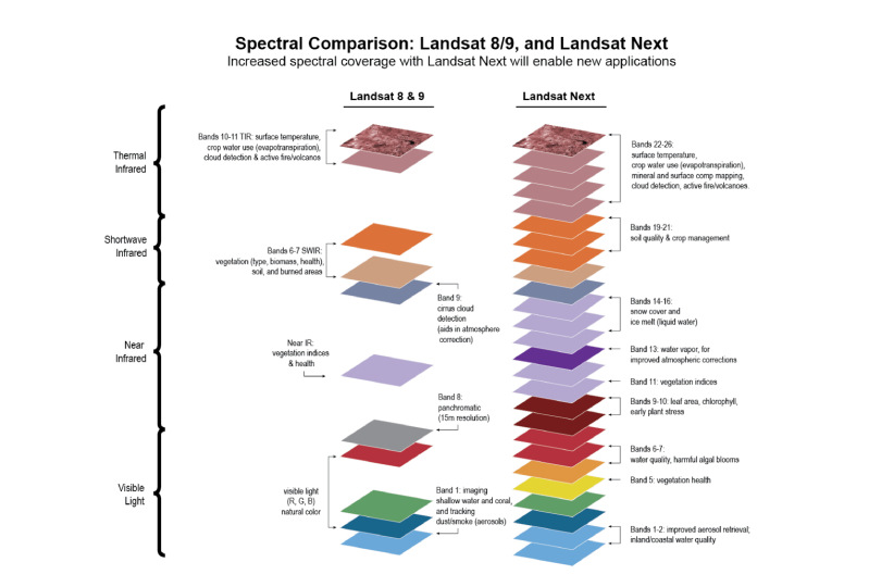
The Landsat Next mission will provide a new and improved capability for the next generation of users, with higher spatial resolution, twice the current number of spectral bands and improved local revisit time.