Recently Completed Geophysical Survey Will Help Protect Critical Infrastructure From Geomagnetic Storms
Science & Tech
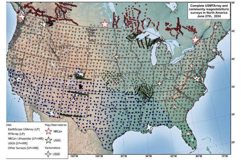
The United States Magnetotelluric Array provides essential geophysical information about the electrical structure of the Earth which will aid in hazard assessments such as those that address the impacts of geomagnetic storms and space weather on electric power grids.
The U.S. Geological Survey, in collaboration with the National Science Foundation, NASA, the EarthScope consortium, Oregon State University, and others, completed the work, which can also help support mineral and geothermal resource assessments.
Magnetotellurics is a geophysical technique that maps how well the rocks of Earth’s crust and upper mantle conduct electricity.
Geoelectric field models comprising USMTArray data and real-time geomagnetic field data provided by the USGS Geomagnetism Program show the current conditions of Earth’s electric field (“geoelectric hazard analysis”) so power-system engineers can assess the vulnerability of critical infrastructure, particularly during geomagnetic storms. Geomagnetic storms generate electrical currents that can damage transformers and cause cascading power failures. By accessing near-real-time information, engineers can adjust operations and avoid potential blackouts or other disruptions.
The USMTArray encompasses data at nearly 1,800 locations across the contiguous United States and has already spurred a wealth of valuable research – including investigations into the geologic structure of the Appalachian Mountains, imaging fluid cycling beneath the western U.S., locating ancient suture zones beneath the Great Plains, mapping the nation’s critical mineral potential, and imaging the deep roots of iconic volcanoes such as Yellowstone.
The rich data set will be mined for decades to come, informing hazard- and resource assessments, illuminating the geologic framework of the nation, and forming the backbone for more detailed investigations.